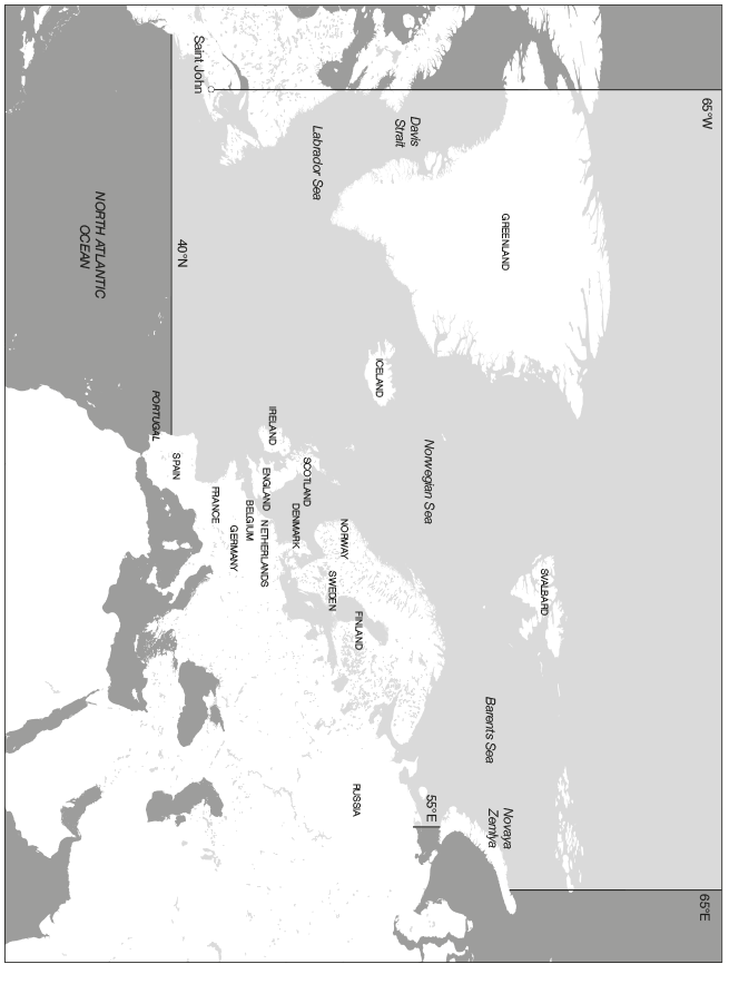
Waters south of 40° north latitude (Map No. 5).
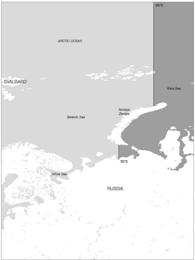
Waters east of 55° east longitude south of Novaya Zemlya and 65° east longitude north of Novaya Zemlya (Map No. 6).
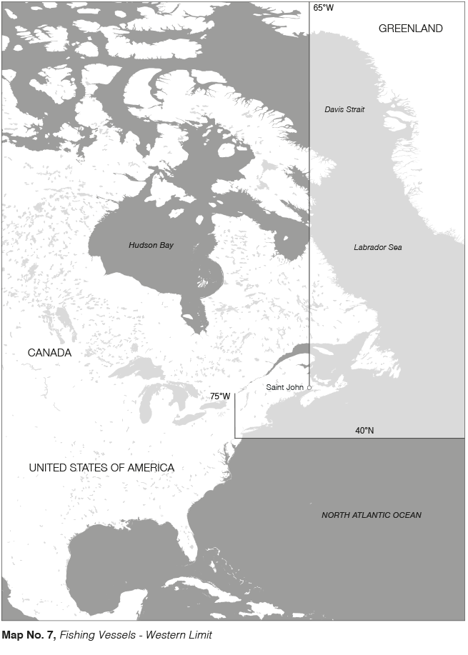
Waters west of 65° west longitude north of Saint John and 75° west longitude south of Saint John (Map No. 7).
Waters with open/scattered drift ice concentration (4/10-6/10) or higher as shown on current ice charts issued by The Norwegian Meteorological Institute.
Clause 17-3. Trading areas for fishing vessels – Map No. 5
Please click on the map to view a larger version.

Clause 17-3. Trading areas for fishing vessels - Eastern Limit – Map No. 6
Please click on the map to view a larger version.

Clause 17-3. Trading areas for fishing vessels - Western Limit – Map No. 7
Please click on the map to view a larger version.

![]() Cefor - The Nordic Association of Marine Insurers
Cefor - The Nordic Association of Marine Insurers![]() Cefor - The Nordic Association of Marine Insurers
Cefor - The Nordic Association of Marine Insurers